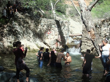
in to take photographs
USFS had the Marines DEMOLISH DAMS with EXPLOSIVES AFTER THEY GAVE US THEIR WORD THAT THEY WOULD NOT DEMOLISH THAT SPECIFIC DAM. Here are the damaging results:
VIDEOS:
Explosives truck - https://youtu.be/TaXMzpfnxm0
Results of swimming hole demolition #1 - https://youtu.be/DRBMS63ET9A
Results of swimming hole demolition #2 - https://youtu.be/nG81F3Egq5U
PHOTOS:
Results of swimming hole demolition #1 - http://www.naturalist-for-you.org/DSCF6610.JPG
Results of swimming hole demolition #2 - http://www.naturalist-for-you.org/DSCF6611.JPG
Results of swimming hole demolition #3 - http://www.naturalist-for-you.org/DSCF6612.JPG
ASSESSMENT OF SITUATION:
1) We have confirmed that Forest Biologist Kirsten Winter is the lead on this project.
2) Explosives were ignited multiple times during wildlife breeding season in a section of Silverado Creek that is officially designated as Critical Habitat for the endangered Arroyo Toad, Kit Fox and Southwestern Willow Flycatcher.
3) No recent Arroyo Toad surveys were conducted in this wet year after years of inadequate drought conditions. Surveys would normally be conducted in spring of wet years.
4) The USFS asked for an exemption from Section 7 of the Endangered Species Act Survey Protocol in order to conduct the explosive demolition project in designated Critical Habitat for the endangered Arroyo Toad but did not ask for exemption for the Southwestern willow flycatchers nesting there and the Kit Fox den.
5) Breeding California Newts, treefrogs, nesting birds and other wildlife were molested, disturbed or possibly killed by the explosives demolition in Silverado Creek. According to their own Environmental Assessment, the USFS is not legally allowed to schedule the project at this time of year.
6) The USFS broke their promise after positive negotiations with the community.
7) The explosives impacted the water clarity and may have impacted the water quality. https://pubs.water.usgs.gov/wri034007
8) The USFS was ineffective at communicating with the public about this project.
9) Our community is heartbroken, but determined to hold the USFS, Marines, USFWS and County accountable for their insensitive, disrespectful and destructive actions.
10) The USFS plans to use these same methods in Holy Jim Canyon, Trabuco Canyon and San Juan Canyon, but we are determined to prevent these destructive methods from happening in the Trabuco Ranger District of the Cleveland National Forest.
Please sign our petition, spread the word and voice your concern to Forest Supervisor William Metz, District Ranger Darrell Vance and local elected officials (congress, supervisor,etc).
Forest Supervisor William Metz via La Sean Brown - laseanbrown@fs.fed.us
I received notice that the Silverado Canyon, California some five dams built in the 1940's will be dynamited in the coming weeks. Blown up and back hoe's digging in this beautiful place. Removing dams will end waterfalls, swimming holes and kill local species. Orange County hikers and naturalists beware!
IT IS LIKELY THE REASON TO DO THIS IS NOT TO ENCOURAGE STEELHEAD TO RETURN TO A PLACE WHERE THEY NEVER NATURALLY LIVED, BUT TO GET
CONTROL OF WATER RIGHTS AND MOVE THE WATER
I contacted my Senator, Audubon Society, the Parks Department and the Rangers who plan to
set the fuses yesterday.
A pair of Southwestern Willow Flycatchers live next to one of the swimming holes, and
yellow legged frogs are hatching in the shallow mud due to the unusual amounts of rain
we experienced. Both of these creatures are on the endangered species list.
The reasoning for dam removal seems to be they believe this will bring steel head up the dry creek. Trout were long ago planted in this area but they are not native.
If you are a hiker or enjoy Holy Jim, Silverado, the Cleveland National Park please contact the links below or give them a phone call ASAP
Appendix B: Response to Comments
Trabuco
District Dam Removal
The Forest Service has documented, analyzed, and
responded to the public comments received during the scoping and comment
periods for the Trabuco District Dam Removal Project. This appendix summarizes
the comments that were received during the scoping and comment periods and
provides the agency’s response to those comments. These responses comply with
40 CFR 1503.4, Response to Comments, of the National Environmental Policy Act
(NEPA) regulations.
Comment Analysis
and Response
Public comments submitted were documented, compiled,
categorized, and analyzed in order to capture all viewpoints and concerns
submitted during the official scoping and comment periods. Information from
letters, emails, and other sources are all included in this response to
comments. The response to comments helps the USDA Forest Service clarify,
adjust, or incorporate additional technical information into the EA.
Comments were not tallied or listened to. The Forest Service is acting on directives from higher sources and doesn't care about public input
Comments were not tallied or listened to. The Forest Service is acting on directives from higher sources and doesn't care about public input
Specialists read all public responses and identified separate
comments within them that relate to a particular concern, resource
consideration, and/or requested management action. Specialists categorized each
comment into a subject area that is specifically relevant to this project.
After categorizing comments, responses were written to address the public input
that was received. The interdisciplinary team provided any recommendations for
improvement to the proposed action to the Trabuco District Ranger for review,
consideration, and action. In general, the agency responds in the following
five basic ways to substantive public comments, as prescribed in 40 CFR 1503.4:
1. Modifying alternatives.
2. Developing and analyzing
alternatives not initially given consideration.
3. Supplementing, improving, or
modifying the analysis documented in the EA.
4. Making factual corrections.
5. Explaining why the comments
do not need further Forest Service response.
This response document is organized based on the
categorization of comments into subject areas, as described above. Therefore,
the organization of this appendix does not directly match the organization of
the EA and is instead more closely tied to the concerns that the public shared
during the scoping period with the proposed action. Comments that may have fit
into several categories were addressed only once.
It is important to point out that the consideration of
public comments is not a vote-counting process in which the project outcome is
determined by the majority opinion. More importantly, it is the appropriateness,
specificity, and factual accuracy of comment content that serves to provide the
basis for modifications to planning documents and decisions. Further, because
respondents are self-selected, they do not constitute a random or
representative public sample. NEPA encourages all interested parties to submit
comments as often as they wish. Every substantive comment and suggestion has
value, whether expressed by one respondent or many. All input is read and
evaluated, and the analysis team attempts to capture all relevant public
concerns in the analysis process.
Per the legal notice, the 30 day period to comment on the
Trabuco District Dam Removal Environmental Assessment began September 24, 2013,
and ended October 24, 2013. Eleven
comments were received by email, two comments were received by USPO mail, and
no comments received by telephone during this time period. Several comments were received after the
close of the comment period and are not part of the official record, although
the Forest agreed to consider late comments.
1. Cost and financial concerns:
1.1 Commenters
stated that the cost of removing the dams was too high and not a good use of
funding.
Waste of Money with no benefit. Who gains from the water course being changed? Who owns the water resource? Where do the riparian rights of owners go? Is the State taking the water?
Waste of Money with no benefit. Who gains from the water course being changed? Who owns the water resource? Where do the riparian rights of owners go? Is the State taking the water?
Response to 1.1: See alternatives
comparison chart, Section 2.4 of Environmental Assessment, which displays the cost of the various
alternatives. See also response to comment 4.8, which discusses the risks of no
action. Please note that the Forest is seeking funds
that are specifically allocated for removal of fish barriers for this project;
these funds, if received, may not be used for other types of projects.
1.2 Purpose and
need does not justify the proposed action
Response to 1.2: See revised purpose and need section in Section 1.3 of Environmental Assessment which provides
additional detail regarding the rationale for the project.
1.3 How can cabin owners seek compensation if
cabins are damaged by project work or subsequent effects.
Response to 1.3 - If cabin owners believe they can show that their
property has been damaged due to a Forest Service action, they may file a claim
for recovery of damages.
2.
Historic concerns:
2.1 The rock dams have historic
value and should be preserved.
Thousands of hikers, artists, writers and locals have enjoyed this area as it stands for the past seventy seven years. Why do you say natural beauty has no merit?
Thousands of hikers, artists, writers and locals have enjoyed this area as it stands for the past seventy seven years. Why do you say natural beauty has no merit?
Response
to 2.1- The Trabuco District Dams are a
series of check dams placed intermittently within Trabuco Creek, Holy Jim
Creek, San Juan Creek, and Silverado Creek on the Trabuco Ranger District of
the CNF. The dams are made of rock and mortar. They were constructed by Orange
County in the 1940s as part of a fish stocking project, in which the County constructed
check dams for an approximately 10 year period. The original objectives of the
program were to enhance local fishing potential, conserve water and wildlife,
and provide water for fire protection. The program boomed during the 1950s and
1960s by creating popular fishing areas. The program began to wane during the
1970s, which led to the deterioration and subsequent removal of some of the
dams. Of the approximately 108 original dams, 81 are still intact to the point
where they need to be demolished to allow for fish passage. These 81 dams are located along Trabuco
Creek, Holy Jim Creek, Silverado Creek, and San Juan Creek. Due to the
potential eligibility of the dams for nomination to the National Register due
to their age (>50 years), association with local history, and the potential
adverse effect of the proposed demolition, the dams were recommended for a Determination of Eligibility (DOE) evaluation
and associated SHPO consultation prior to any decision regarding the proposed
demolition, in accord with Section 106 of the National Historic Preservation
Act (NHPA) and the Regional Programmatic Agreement (RPA 2013).
An evaluation and draft DOE report for
the three intact dams in Trabuco Creek was prepared by the Heritage Stewardship
Group (HSG), a U.S. Forest Service Enterprise Business Unit specializing in
historic preservation and cultural resource management. To develop the DOE,
HSG’s Architectural Historian utilized data and documentation provided by the
CNF Heritage Program, Trabuco Ranger District, Orange County Archives, Orange
County Historical Society, Cal Fire, and Orange County Fire Authority in
addition to using secondary literature. Project fieldwork was completed by
Forest Heritage Program and Resources staff in March 2013. Fieldwork included
photography and documentation of the physical aspects of all of the 108 known
check dams and the surrounding landscape. The evaluation was completed by an
architectural historian who meets the Secretary of the Interior’s Professional
Qualifications Standards per 36 CFR 61. The draft report is in the process of
being rewritten to include documentation (DPR Archaeological Site forms),
evaluation and DOE for all of the 108 known dams that may potentially be
included in the demolition project, rather than just the three primary intact
dams in Trabuco Creek, based on verbal consultation with SHPO. The projected
completion date for the final draft is January 2014. The original evaluation
resulted in a preliminary determination that the three intact dams, although of
some local interest and importance, do not meet any of the four National
Register criteria for significant Historic Properties, according to the
Architectural Historian that conducted the evaluation. SHPO verbally indicated
that it could concur with that determination, and that the remainder of the
dams would not be considered historic by association, as they are in very poor
condition and are lacking in integrity, or have been removed completely. Once
the draft evaluation has been provided for public comment it will be finalized
and submitted to SHPO for concurrence, prior to any decision regarding the
proposed demolition of the dams, in accord with Section 106 of the NHPA and the
RPA.
3.
Scenic
values concerns.
3.1 Dams and
associated “waterfalls” are scenic and should be preserved. Removal of the dams
will impair the scenic integrity of the area.
Say goodbye to all the waterfalls that hikers enjoyed. Water will go underground
Response to 3.1– Please see expanded discussion of Scenery
Objectives, Section 3.3 of
EA. The CNF Land Management Plan
(2006) specifies a Scenic Integrity Objective level of “High” for the entire
project area, a classification that “provides for conditions where human
activities are not visually evident.” In other words, man-made artifacts like
dams are considered to detract from, rather than add to, the area’s scenic
integrity.
3.2 Leaving
rock materials in place after dam demolition will decrease scenic value of
area; waste materials will be left in unsightly mounds
Response to 3.2. Please see additional discussion, Section 3.3
of EA. Please note that all of the streams currently have roads, road
crossings, rip-rap, gabions, retaining walls, remnants of failed dams, and
other types of materials present in and adjacent to stream channels. Due to the
dynamic nature of these streams, rock and concrete fragments resulting from dam
demolition will be transported downstream and out of the project area over
time, during rainfall events.
3.3 Defunct
installations such as these dams detract from the forest experience and should
be removed.
Response to 3.3 – Thank you for
this comment, which supports the information presented in the Environmental
Assessment.
3.4 Holy
Jim Canyon is not a Wilderness so it should not be restored to a more natural
condition.
Response to 3.4 - Please note that the Forest Land Management
Plan states that Scenic Integrity
Objectives for Trabuco/Holy Jim, San Juan, and Silverado are “high”; and Ortega
Highway Corridor (San Juan) is a Scenic Byway.
A Scenic Integrity Objective of “High” is the equivalent of a landscape
that appears unaltered. See Scenic
Integrity Objectives map in Forest Plan.
The landscape strategy (Land Management Plan Part 2, page 105) includes
direction to “Restore landscapes to reduce visual effects of management
activities and nonconforming features”.
Appendix E provides direction for Riparian Conservation Areas, and
states that the Forest will allow “only those actions that maintain or improve
long-term aquatic ecosystem health.”
Please see also the discussion of scenic values, Section 3.3 of EA.
4.
Hydrological
concerns:
4.1 Removal of dams will increase
the extent of the floodplain in and downstream of project area
Response to 4.1 – The dams were
not constructed for flood control. At a
6th field watershed HUC scale, they have not changed the
duration, timing, or water inundation levels during past major flood events
such as the 50-100 year floods of 1938 and 1969. Therefore, the 100-year floodplain width that
existed prior to dam construction is the same width that occurs today 40-70
years after the structures were initially constructed. Although the extent and
function of the 100-year floodplains are not affected by this project, due to
the interest expressed by several commenters, additional information about
floodplain mapping is provided here.
Floodplains are the relatively flat lowland that borders a river, usually
dry but subject to flooding. Floodplain soils actually are former flood
deposits (USGS webpage, 2013).
Existing FEMA flood mapping for San Juan, Silverado, and Trabuco Creeks
covers areas just downstream of the Cleveland National Forest boundary (FEMA
Map Service Center, 2013) The FEMA
mapping shows that the floodplains in these streams overlap with two soil
types- Riverwash, and Soboba cobbly
loam. The USDA Soil Conservation
Service has mapped soils in this area (USDA Soil Conservation Service 1978) and
describes these soil types as follows:
Riverwash – Riverwash consists of
areas of unconsolidated alluvium, generally stratified and varying widely in
texture, recently deposited by intermittent streams, and subject to frequent
changes through stream overflow.
Soboba series - The Soboba series consists of excessively
drained soils on floodplains and alluvial fans.
Since
FEMA maps were not available for Forest lands, the Forest followed the
direction in Executive Order 11988 on Floodplain Management (1977). This order
states that “if such maps are not available, the agency shall make a
determination of the location of the
floodplain based on the best available information.” On National Forest System lands, floodplain
soils (Riverwash and Soboba series) are present along the stream channels in
Silverado, Trabuco, Holy Jim and San Juan Canyons. A map of the extent of floodplain
soils for Holy Jim and Trabuco Creeks is provided in Figure 1.
Figure 1. Extent of floodplain soils mapped by the USDA
Soil Conservation Service in 1978.
Figure 1 indicates that the roads and recreational residence in both
Trabuco and Holy Jim Canyons were constructed within the currently mapped 100
year flood plain. Removal of the dams
will not change this fact.
4.2
Request for document that mapped 100-year floodplain
Response to 4.2 – No formal
mapping of the 100-year floodplain has been completed by the Federal Emergency
Management Agency (FEMA) on National Forest System lands within the project
areas. However, the USDA Soil Service
mapped the floodplain soils in each of the project area canyons in 1978. The extent of these mapped soils provides an
accurate depiction of the present day 100-year floodplain due to the
constraints of the canyon geomorphology.
See response 4.1 for more detail on this subject.
4.3 Removal of dams will increase
flood risk to cabins/historic cabins, roads, trails, trees, retaining walls.
GO TAKE A LOOK AT THE TRAILS today flooding and historic storms have brought down debris Studies cough cough a few rangers and a cell phone camera do not take a look at what changed from 2013 study during drought and current conditions
GO TAKE A LOOK AT THE TRAILS today flooding and historic storms have brought down debris Studies cough cough a few rangers and a cell phone camera do not take a look at what changed from 2013 study during drought and current conditions
Response to 4.3 – The dams, built
by Orange County between the 1940s and mid-1970s, were not built to provide for
flood protection and were never operated to provide for flood control. Each dam had a wooden gate that was placed in
the center of the dam each spring to retain water through the summer. Gates were then removed in the fall to allow
water to flow through the dam during winter storms. Therefore, removal of dams would not impact
the risk to future flooding during major storm events. Five of the dams in Holy
Jim Creek were built or rebuilt without central gates; these dams have filled
with sediment and do not store water. Figure 2 shows flood damage in Trabuco
Canyon from the winter of 1937-1938. There have been other flood events that
have damaged infrastructure during the time after the dams were constructed,
primarily in 1969 when 6 cabins washed away and another 5 cabins were
undermined or damaged. These canyons are
highly dynamic and flashy systems that developed naturally through episodic
flooding events over time.
Figure 2. Historical photo from the winter of 1937
showing flood damage in Trabuco Canyon after
a significant winter rainfall event.
Photo courtesy of James Newland.
A higher risk of increased
flooding would occur if the dams are left in place. Over time, unmaintained dams have the
potential to fail. This failure could
cause stream channel avulsion during higher flows which could potentially
damage established infrastructure.
4.4 Removal of
dams will increase erosion risks
Response
to 4.4 – In the short term, removal of the dams would promote increased erosion
of the material that has been trapped behind the dams. Because of this, we would remove a set of
dams in areas with higher values at risk (Holy Jim Canyon) systematically and
let the material work itself through the system before another set number of
dams would be removed. The removal would
take at least 3 years depending on the reworking of the stream due to
precipitation over that time. The
alternative to systematically removing the dams would be to let them fail
naturally. There is no intention by
Orange County to maintain these dams in the future. Because of this they will inevitably fail. When this happens it is probable the trapped
material would be released downstream at once. Depending on the magnitude of the storm and
failure of the dams, allowing this to happen could have significant impacts to
downstream infrastructure including cabins and roads.
4.5 Removal
of dams will release excessive/dangerous amounts of sediment
Response to 4.5 – See response to
4.4.
4.6 Removal
of dams will cause catastrophic flows of water and sediment
Response to 4.6 – See response to
4.4
4.7 Removal
of dams will impact the performance of nearby wells needed for domestic water
supply and firefighting
Are you crazy with this lie? AS the course of water flow is changed, and DIVERTED the Forest Service is moving the water to someone else. Are you sending water to Moulton Ranch? Are you giving water to the Water District?
Are you crazy with this lie? AS the course of water flow is changed, and DIVERTED the Forest Service is moving the water to someone else. Are you sending water to Moulton Ranch? Are you giving water to the Water District?
Response to 4.7 – Wells used by
residential tract residents in Holy Jim Canyon are solely groundwater
wells. There are no surface water
intakes that would be affected by the anticipated short term sediment release. Groundwater recharge in these areas could
only be impacted by drought and/or water diversions. To our knowledge, there are no significant
upstream diversions impacting groundwater recharge in the Holy Jim area.
As for firefighting, we have
identified reliable water source points in each of the Canyons should water be
needed. The plan does not include any of
the pools created by the existing dams.
4.8 Hydrology report
underestimates the nature of storms in SoCal, specifically El Nino events;
commenter implies that cabin owners will be at increased risk during these
storms if dams are removed.
Response to 4.8 – Holy Jim and Trabuco Canyons are highly dynamic and
flashy systems that developed through episodic flooding events over time. This is evidenced by the alluvial fan where
the cabins in lower Holy Jim are located.
The reason that this area is flatter and wider than the rest of the Holy
Jim Canyon is because the gradient drops once the channel leaves the confined
section of Holy Jim and enters the recreational residence area. In less
confined areas of a channel, stream velocity and carrying capacity decreases,
resulting in sediment deposition. It is
natural for the channel to drop material here and subsequently migrate back and
forth across the channel bottom as evidenced in both Holy Jim and Trabuco
during past flooding events such as in 1937, 1965, 1969, 1998, 2008, and
2010.
The stream channel through the
cabin area has been channelized in the past in an attempt to protect the cabins
in the area. This channelization creates
more energy downstream of the cabins and contributes to the damage that occurs
in Trabuco Canyon, specifically Trabuco Canyon Road after significant storm
events. Further, the dams were never
intended to protect the cabins from flooding.
This is evidenced by a video provided by recreational residence owner
Milligan where the water is completely overtopping a dam just above the
cabins. If it was a flood control
structure the water would be captured and released into the system at a later
time.
The bottom line, from a hydrology
and geomorphology perspective, is that the recreational residence tracts in
Holy Jim are located in an area that over geologic time is extremely
dynamic. The current dams are not protecting
cabins from flooding or stream channel avulsion. The bigger risk is the fact that these aging
non-flood control dams, of which are not being maintained and will not be
maintained in the future, will fail someday.
When that happens the material that has been trapped upstream of the
cabins would be released into the system with potentially damaging
effects. This represents a much larger
risk to the cabins and downstream infrastructure than if the Forest Service
systematically removes them using sound scientific and engineering principles.
4.9 Removing dams will create a downstream
Venturi effect that will increase scouring and erosion, endanger cabins and
roads, trails, trees
Do you want to provide flood insurance and allow rebuilding of the cabins after you destroy them?
Do you want to provide flood insurance and allow rebuilding of the cabins after you destroy them?
Response to 4.9 – The Venturi
effect is the reduction in fluid pressure that results when a fluid flows through a constricted section
of pipe. Because this project does not
involve fluid in a pipe, the Venturi principle is not valid for this project. The
dams funnel and channel stream flow, creating a scouring effect downstream.
Removal of the dams will decrease this scouring action.
4.10
Photos from 1969 demonstrate destructive potential of floods- hydrology report
needs to consider this.
Response to 4.10 – The photos provided by Mr. Milligan illustrate the
dynamic nature of the stream systems in the Santa Ana Mountains. When significant precipitation occurs, the
streams become flashy, dynamic and dangerous.
The photos illustrate that infrastructure becomes vulnerable and that
the existing dams do not provide any protection when heavy precipitation and
subsequent flooding occurs. A mention of
the 1969 event was updated in the hydrology specialist report.
4.11
Some of the cabins are historic. They
will be at risk and may be destroyed if dams are removed.
Response to 4.11 – The dams, built by Orange County between the 1940s and
mid-1970s, were not built to provide for flood control and were never operated
to provide for flood control. There is
currently no flood control for any of the cabins in the Holy Jim, Trabuco, or
San Juan cabin tract areas. Naturally, these
streams are highly dynamic systems with the potential to produce large floods
that could damage local infrastructure as evidenced by past events. The removal of dams will not change this risk
into the future. Forest records
indicate that approximately 21 cabins in the Holy Jim and Trabuco tracts have
been lost to floods since the 1940’s -
approximately 15 cabins in the 1937/1938 floods, and 6 in the 1969
flood. There is a high baseline risk of
flooding in this area that is not influenced or affected by the proposed
action.
5
Biological
concerns:
5.1 Removal of
dams may harm Sticky Dudleya and
Ocellated Humboldt Lily plants; these should be salvaged from work areas This was not done. Plants are gone. Evidence of weed wacking.
Response to 5.1. The proposed
action has been revised to include salvage and replanting of these species, see
Section 2.1.1 of EA, General Resource Protection measures, item 7.
5.2 Removal of
dams will not benefit steelhead as they are not currently present; steelhead
will not recolonize these streams – impossible to create a migration route for them
Response to 5.2. The impediments
created by multiple fish-passage barriers within each creek are a concern
addressed by the Southern California Steelhead Recovery Plan (NMFS 2011). We fully recognize that restoring suitable
habitat conditions for steelhead migration, spawning, and rearing of young will
require multiple management actions by several agencies over many years. The physical modification of road crossings
and other barriers has been listed by NMFS as a critical recovery action for
this geographic area. NMFS has indicated
a plan to address impassable barriers in the downstream portions of the creeks. The Forest Service’s plan is to implement
this recovery action within our own boundaries, as funding permits, which
supports both the recovery plan as well as our management plan. Additional discussion of this concern appears
in section 3.2.1 of the EA.
5.3
No evidence that steelhead ever occupied Trabuco
Creek – trout there were planted.
Reponse to 5.3. The National
Marine Fisheries Service performed an extensive review of Southern California
Steelhead for the 2012 Recovery Plan in which they determined that tributaries
within the Southern California Steelhead Recovery Planning Area, including the
San Juan Creek/Arroyo Trabuco watershed, were historically occupied and have
the potential to support steelhead in the future once man-made barriers are
removed. Additional discussion of this
concern appears in section 3.2.1 of the EA. NOPE
5.4 Removal of
dams will not benefit steelhead unless downstream barriers are also removed
(Four Trabuco Ck road crossings, et al.) implementation of dam removal should
be incremental, should be delayed and implemented only after downstream
barriers are removed.
Response to 5.4. The Southern California Steelhead Recovery Planning Area
includes portions of the coastal watersheds that are currently inaccessible to
steelhead due to man-made barriers. The
National Marine Fisheries Service has identified physical modification of
barriers such as road crossings, highways, and railways as a critical recovery
action in the Recovery Plan (NMFS 2011).
Modification of these fish passage barriers is a necessary first step to
providing functional habitat to steelhead and other native fish. In recognition of this, the Forest Service is
working proactively to remove the barriers from our lands as funding is
available. Additional discussion of this
concern appears in section 3.2.1 of the EA.
5.5 Trabuco/Holy
Jim do not have enough water to support a persistent resident population of
steelhead .
Response
to 5.5. The Southern California
Steelhead Recovery Planning Area (NMFS 2011) includes portions of the coastal
watersheds that are only seasonally accessible to migrating steelhead. While it is true that due to relatively low
average rainfall in the region many of the drainages are seasonally dry or can
have extensive dry portions, steelhead will attempt to move upstream into upper
portions of a stream when water flow conditions are favorable for
migration. Therefore, we will work to
improve creek habitat on the Forest in preparation for the years when
conditions support movement to and use of the habitat by steelhead. Additional discussion of this concern appears
in section 3.2.1 of the EA.
5.6 Forest
vegetation is already changing due to drier climate (eg death of alder trees),
drier conditions will make it difficult for steelhead to access Trabuco
Ck.
Response to 5.6. The Mediterranean climate of southern
California has long dry summers, and brief winters with short, intense
storms. Steelhead have been a part of
this ecosystem for a very long time and have adapted to the “flashy” hydrologic
conditions. While climate change
predictions suggest storm and drought cycles may be amplified in the future,
steelhead will have opportunities to migrate upstream in tributaries when the
flow conditions are favorable (NMFS 2011).
Additionally, the ability of the species to switch between multiple
life-history strategies (freshwater residency and/or anadromous migration) will
be an important adaptive response to changing, highly variable environmental
conditions. Additional discussion of this concern appears in section 3.2.1 of
the EA.
5.7 Removal of
dams in Holy Jim/Trabuco will not benefit steelhead or arroyo toad.
STEELHEAD ARE NOT NATIVE TO THIS AREA
STEELHEAD ARE NOT NATIVE TO THIS AREA
Response to 5.7. Over time, the
dam removal will benefit both of these species as release of sand and gravel
from the dams will improve the condition of spawning or breeding habitat for
these species downstream of the project area, as well as improving aquatic
organism passage within and upstream of the project area. Please see section
3.2.2 of EA.
5.8 Removal of
dams will not benefit arroyo chub.
Removal of dams will substantially benefit arroyo chub as their
populations are currently fragmented by the dams. Please see sections 3.2.2 of EA and response
to comment 5.15.
5.9 Arroyo
chubs and pond turtles are not present in Trabuco/Holy Jim Creek.
pond turtles ARE present, yellow legged frogs and southwestern Willow Flycatchers
pond turtles ARE present, yellow legged frogs and southwestern Willow Flycatchers
Response to 5.9. Forest records and range maps for these species indicate
that there is occupied or potential habitat for these species in Trabuco and
Holy Jim Creeks, so these species must be considered in the project analysis.
5.10
There are no horned lizards in Trabuco Canyon.
Response to 5.9. Forest
records and range maps for these species indicate that there is
occupied or potential habitat
for these species in Trabuco and Holy Jim Creeks, so these
species must be considered in
the project analysis.
5.11
Removal of dams will harm wildlife species such as migratory birds.
Response to 5.11. The project may result in a short term disturbance to
migratory birds as described in the EA.
Effects on migratory birds will be minimized by completing project work
in the fall when few birds are nesting.
Migratory birds will experience a long-term benefit from the project as
the streamside habitat recovers after removal of dams. Please see section 3.2.4 of EA.
5.12
Fish ladders should be installed to allow for fish movement.
Response to 5.12. Please see the analysis of Alternative 3, in
section 2.3 of EA. Fish ladders are not feasible because they do not meet the
purpose and need of the project, and they are extremely expensive.
5.13 Special use permittees (rec cabin
owners) protect the native wildlife such as newts, snakes, lizards, and have
built small dams to preserve pool habitat for California tree frog tadpoles.
Response to 5.13. The Forest appreciates the efforts of
recreation cabin owners to protect wildlife.
However, dam construction is not allowed by the recreation cabin special
use permits and requires state and federal permits.
5.14
Dams are a refuge for wildlife including snakes, lizards, frogs and newts.
Response to 5.14. The stream will
continue to have pools and rocky banks after dam removal, which will provide
habitat and refuges for these species. Please see Section 3.1.2 of EA for further
information.
5.15 Trout, fish, salamanders do not need to move
up and downstream to maintain populations.
Response to 5.15 - Fish and other
aquatic wildlife do need to travel up and downstream to seek out suitable
mates, breeding habitat, and feeding habitat.
As summarized in the EA, Section 3.2.2, and in Hoffman (2007);
“Movement
is an essential mechanism by which mobile animals acquire the
resources
necessary for the successful completion of their life-cycles (Greenwood and
Swingland
1983; Dingle 1996). It also plays a crucial role in how animals are distributed
across
the landscape and the persistence of populations and species (Ricklefs
1990;Fausch et al. 2006).
6
Hazardous
Materials concerns:
6.1 Removal of dams will release arsenic and mercury that were used in
Holy Jim placer mine operations.
LIES The wells up off Ortega have arsenic, heavy metals and toluene solvents poisoning the water. They never tested this. Demonstrate you tested the metals used in structure. Mining permits did exist here and still do today.
LIES The wells up off Ortega have arsenic, heavy metals and toluene solvents poisoning the water. They never tested this. Demonstrate you tested the metals used in structure. Mining permits did exist here and still do today.
Response to 6.1: The Hydrology Report discusses in detail the beneficial
uses and State of California 303d listing status of waters near the project
area. Holy Jim Canyon is not, nor has it been, listed by the state for any
water quality issues related to arsenic or mercury. Although the Forest does
not have records of historic mining, some small scale mine tailings have been
observed, which indicates that mining could have occurred at some time.
However, because there have not been elevated mercury or arsenic levels in Holy
Jim Canyon historically (no historic 303d listing), there is no evidence that
there would be elevated levels of arsenic or mercury resulting from project
implementation in the near future.
6.2 – Commenter states that protective measures such as spill prevention
will not be adhered to.
Response to 6.2: Project Design
Features, including best management practices (BMPs), site-specific
mitigations, and Forest Plan Standards and Guidelines are an integral part of
implementing the project.
BMPs have been designed to protect and restore watershed resources.
Implementation of BMPs ensures adherence to the Federal Clean Water Act.
All federal agencies must comply with the provisions of the Clean Water Act,
which regulates forest management activities near federal waters and riparian
areas. Additionally, the 2005 Cleveland Forest Plan directs water quality to be
maintained and improved through the use of state certified and Environmental
Protection Agency (EPA)-approved BMPs. The design features and BMPs associated
with the proposed action ensure that Sections 208 and 319 of the Federal Clean
Water Act (PL 92-500) and the guidelines established by the Santa Ana and San
Diego Regional Water Quality Control Boards (California Regional Water Quality
Control Board, Santa Ana River Basin, 2008, California Regional Water Quality
Control Board San Diego, 1994, amended 2011) are met.
Spill prevention and containment measures are required to be in
compliance with the National Best Management Practices (BMPs) AqEco-2, which
states “…Promptly install and appropriately maintain spill prevention and
containment measures…” (USDA, 2012). The EA discusses water quality (chemical
contamination) on page 28-29 and states that BMPs would be implemented as part
of the project specifications.
Overall, to be in compliance with the Federal Clean Water Act, BMP
implementation including spill prevention is mandatory.
7
Fire
management issues:
7.1 – Removal of dams will prevent use of stream pools for firefighting
efforts as pools will fill with sediment
Response to 7.1- The dams have
central gaps or openings where gates were once placed. The gates have not been in use for 20 years
or more, and the dams do not store water.
Some dams have plunge pools downstream; after dam removal pool locations
may shift but pools will still be present and will be available for emergency
firefighting. In general other water sources such as water tanks, or aerial
drops of water from nearby lakes, are the preferred sources of water for
firefighting. See Hydrology report and section 3.1.2 of EA for further details.
8
Safety concerns:
8.1 – Concern that use of explosives to demolish dams will damage cabins
and adjacent roads in Holy Jim/Trabuco Creek. What actions will be taken to protect cabins
and facilities?
Response to 8.1 - The project includes
several measures to protect cabins and facilities. See expanded description of
proposed action, Section 2.1 which describes using a phased approach to allow
gradual release of sediment at Holy Jim Creek, avoiding use of explosives near
roads and structures at Holy Jim Creek, and preparing detailed engineering
designs for demolition of dams near roads and structures.
8.2 – There are no safety hazards associated with recreational activity
on and around dams.
Response to 8.2. Historically,
when dams were in operation and seasonal gates were installed, there were
several serious injuries associated with people jumping or diving from the
dams. Since the county stopped
installing the gates, these problems have decreased but there is still
potential for people to climb on the dams and jump or fall from these
structures. Please see section 3.3.1 of
EA.
9
General
support for proposed action.
9.1 In favor of
removing dams to restore natural flows and replenish beaches downstream
9.2 Supports
removing dams which are useless infrastructure that encourages graffiti.
9.3 Supports
removing dams to restore riparian vegetation and fauna
Response to 9.1, 9.2. 9.3 - Thank you for these comments, they support
the discussion in the Environmental Assessment.
10
Other concerns:
10.1- Question about desired condition for Silverado Place (EA p. 7) –
what communities are
protected?
Response to 10.1 – This phrase
refers to providing an open space area that is a refuge for human visitors.
10.2- Request to change the order of items in project description – p 11
and 13- move up items regarding equipment
cleaning to top of list.
Response to 10.2 – This change has been made and items were re-organized
for clarity, see Section 2.1.1 of Environmental Assessment
11
Comments
outside the scope of current analysis or already decided by law or regulation:
11.1 Concern about the maintenance level of
Trabuco Creek Road. Use funding to maintain road.
Response to 11. 1: The Forest is
aware of maintenance concerns for Trabuco
Creek road. This issue is beyond the scope of the current
project and will be
addressed in a subsequent
analysis. The funding that is available for dam removal cannot be used for road maintenance, which is funded
under a different authority.
11.2 When will effects of Trabuco Creek Road on
stream habitat be addressed.
Response to 11. 2: The Forest is
aware of concerns about the effects of Trabuco Creek Road on stream habitat. This
issue is beyond the scope of the current project and will be
11.3
Concern about the forest’s arundo removal project and arundo piles near project
area.
Response to 11.3. The weed removal project was addressed under
a separate Environmental Assessment, and is outside the scope of the current
analysis.
11.4
Concern about water rights for cabin owners.
Response to 11.4. Water rights are administered by the State of
California; this concern is outside of the scope of the current analysis.
11.5
Concern about the impacts of human population growth.
Response to 11.5 - The Forest does
not have the authority to regulate population growth; this concern is outside
of the scope of the current analysis.
11.6
Request for additional time to submit comments.
Response to 11.6. The length of the comment period is set by the Code of
Federal Regulations, which does not allow for extensions.
11.7
Removal of dams will eliminate fish stocking/fishing opportunities.
Response to 11.7. Fish stocking is
under the authority of the California Department of Fish and Wildlife; they are
aware of this project and support dam removal. See CDFW’s website regarding
fish passage at http://www.calfish.org/
11.8
Project work should focus on San Mateo Creek.
Response to 11.8. There are no dams in San Mateo Creek on
National Forest System lands. San Mateo
Creek is not part of the current analysis.
11.9
One commenter indicated that he should be hired under contract for the
environmental analysis and dam removal work.
Response to 11.9 - Any work that
is contracted is subject to competitive bidding; this is required by Federal Acquisitions
Regulations.